North Fork Malheur River
North Fork Malheur River
Oregon
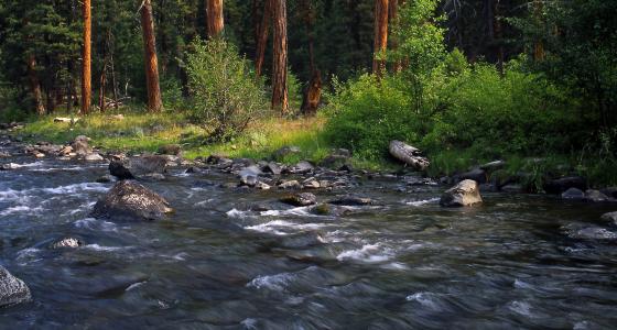
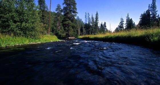
The Malheur River corridor is generally characterized by a broad valley carved by glacial activity in the upstream northern half and by a rugged, steep canyon ranging from about 250- to 750-feet deep in the south. The canyon geology is evident in the various rock outcrops, talus slopes, and cliffs that contribute significantly to the scenic diversity of the landscape.
Evidence of human presence is moderate in the northern half and very limited in the southern half. Wildlife habitat is extremely diverse and of exceptionally high quality because of these undisturbed conditions. The river corridor also provides important connectivity between the Blue Mountains and Great Basin physiographic provinces. Camping, fishing, hiking ,and hunting are popular.
Designated Reach
October 28, 1988. From its headwaters to the Malheur National Forest boundary.
Outstandingly Remarkable Values
Fish
This is an important recreational fishing area, both locally and regionally. Game fish include native redband trout, rainbow trout, bull trout, and mountain whitefish. Because of the dams constructed downstream, these populations are now reproductively isolated. The river is an important producer of native fish, and it has a significant recreational trout fishery.
Geology
Bedrock material along the entire river section consist of Miocene- to early Pliocene volcanic flow rocks. The river channel passes through areas where glacial moraine deposits and other alluvium have been deposited on top of these bedrock materials. The area is in a series of essentially horizontal lava flows layered on top of one another, rarely exceeding 40 feet in thickness. Some of the flows have a massive columnar structure, with columns up to eight feet in diameter. These volcanic materials are best exposed where the river has carved the deepest canyon. Total relief at any one site in this section ranges from 250 to 750 feet, and some of the more prominent features include rock outcrops, talus slopes, and areas above the channel with relatively flat slopes. Some outcrops form vertical cliffs as high as 50 feet.
Scenery
Vegetation is diverse but dominated by large, old, orange-barked ponderosa pine trees which contrast with background vegetation and reflect in the calmer waters. Numerous meadows break through, providing opportunities for views until the river enters the gradually deepening canyon in which the landforms become much steeper and more dissected. Rock forms are extremely diverse.
Wildlife
The river corridor contains important indigenous wildlife species, including Rocky Mountain elk, mule deer, black bear, pine marten, pileated woodpecker, other woodpeckers and sapsuckers, osprey, bald eagle, and falcons, as well as providing a contiguous migration route for various species. While these species are also found outside the river corridor, the high-quality wildlife habitats include dense mixed conifer stands, lush meadow areas, talus slopes, rock outcrops, and riparian habitat. The overall length of the habitats far exceed other river corridors in the area, and the distinctive and dynamic habitat types are interactive, providing contiguous conditions both horizontally and vertically, creating an excellent connectivity corridor rich in species diversity.