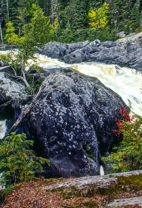
Allagash River
Maine
The Allagash Wilderness Waterway is a state-administered waterway. The Waterway was established in 1966 and is the first state-administered component of the National Wild and Scenic Rivers System, being designated as a wild river in 1970. The Waterway stretches 92.5 miles and includes Allagash Lake, the Allagash River, and several interconnecting lakes and ponds.
The experience of visiting the Allagash Wilderness Waterway is largely defined by the forests, wildlife, and unusual features encountered along the way—bald eagles nesting in towering eastern white pines; moose and deer feeding along the edges of the watercourse; ospreys soaring overhead; loons filling the evening air with their haunting cries; views of nearby mountains and of Katahdin from the larger lakes; or the ice cave on Allagash Lake.
Designated Reach
July 19, 1970. The main stem from Telos Lake Dam northerly to the confluence with West Twin Brook; the main stem from the juncture with the west boundary of T.S, R. 14 easterly to the inlet of the Allagash at Chamberlain Lake. The designation includes all associated lakes, rivers, and streams.
Outstandingly Remarkable Values
Culture
The Native American heritage inherent in the river is reflected in many of the names given to the lakes, ponds, and streams by the Abenaki Indians, who once hunted and fished this entire area. Numerous Native American archaeological sites are present along the watercourse, some identified and documented, others still to be located.
During the early years of commercial activity, the watershed was managed primarily for its timber resources. Early recreational visitors to the Allagash relied on these facilities built to serve the timber industry. Chamberlain Farm and Churchill Depot served as re-supply points and safe havens in the woods. Eventually, purpose-built sporting camps were developed along the waterway to specifically serve the needs of hunters and fishermen.
Of the many people who have visited the Allagash watershed, Henry David Thoreau is probably the most well-known. Thoreau made three trips into Maine to “Ktaadn” in 1846, to Chesuncook Lake in 1853, and to the “Allegash and the East Branch of the Penobscot” in 1857.
Ecology
In the Allagash watershed, the northern hardwood transition forest meets the boreal spruce-fir forest that sweeps across Canada and the northern United States. The forest types that dominate are spruce-fir and northern hardwoods. In addition, there are pockets of black spruce bog, northern white cedar swamp, and silver maple floodplain forest.
Fish
Coldwater fish species are indigenous to the Allagash watercourse. Several lakes are deep with cold, well-oxygenated water in the bottom depths during the warm months of summer and support populations of lake trout (togue), brook trout, lake whitefish, round whitefish, and burbot (cusk). The river and its tributary streams are swift flowing and provide a variety of habitat type to sustain wild brook trout.
Geology
The bedrock geology of the Allagash Region is relatively free of the intense geological processes evident elsewhere in Maine. Instead, the Allagash is dominated by the approximately 400-hundred-year-old Seboomook Formation, a remarkably uniform sequence of sedimentary rock units named for excellent exposures near Seboomook Dam in western Maine.
Fossilized reef fragments, traces of corals, remnants of spongelike stromatoporoids, and small marine invertebrates, such as brachiopods, tell a story in which the lands now underlying the Allagash were once beneath a warm sea.
Recreation
The Allagash Waterway is a popular fishing destination for both summer and winter anglers. Sport fishery management by the Department of Inland Fisheries and Wildlife emphasizes wild populations of lake trout, brook trout, lake whitefish, and burbot.
Wildlife
Principal wildlife species found within the watershed include the three most important big game species in Maine—white-tailed deer, moose, and black bear. Currently, there are eight documented eagle nests within the Waterway.

