Verde River
Arizona
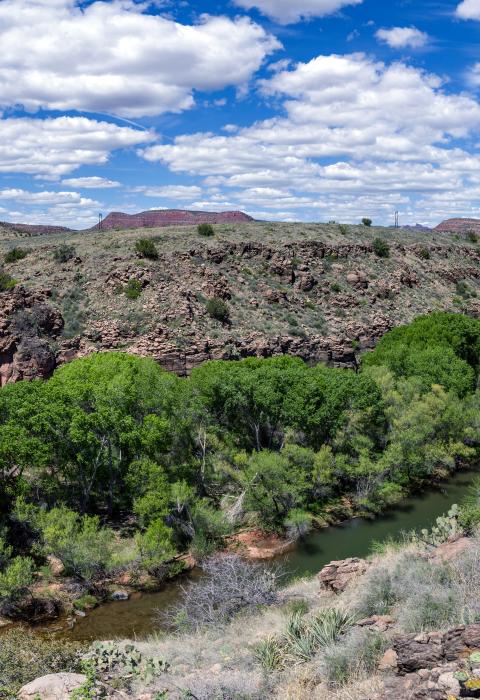
The Verde River is a unique and important resource in Arizona. In a southwestern state where perennial flowing water is rare, the riparian oasis of the Verde River stands in stark contrast to the arid uplands where it meanders. Indeed, Verde is the Spanish term for the color "green." Major river access points are at White Bridge where State Highway 260 crosses the river east of Camp Verde, at Beasley Flats via Forest Roads 574 and 529, and near Childs Power Plant via Forest Roads 708 and 502. The Verde River provides diverse recreational opportunities including boating, hunting, fishing, birding, hiking, picnicking, and photography.
Designated Reach
August 28, 1984: Scenic River Area: The northern boundary of the Scenic River Area is the section line between Section 26 and 27, T13N, R5E, Gila-Salt River meridian. The southern boundary is the boundary of the Mazatzal Wilderness which is within Section 11, T11N, R6E. Wild River Area: The northern boundary of the Wild River Area is the boundary of the Mazatzal Wilderness which is within Section 11, T11N, R6E. The southern boundary is at the confluence of Red Creek with the Verde River within Section 34, T9 l/2N, R6E
Outstandingly Remarkable Values
Culture
The river corridor contains archaeological evidence of occupation and agricultural use and modification of the Verde River floodplain, terraces, and hill slopes by people related to the Hohokam and Southern Sinagua cultural traditions over a period of at least 600 years. It may contain sites of human use and occupation from as long as 8,000 to 10,000 years.
Fish
The river's high-quality habitat supports more than 50 threatened, endangered, sensitive, or special status fish and wildlife species. Periodic natural flooding creates a diversity of aquatic habitats and makes the river a unique and valuable resource in the Southwest. Native fish species include razorback sucker, Colorado pikeminnow, roundtail chub, Sonora sucker, desert sucker, longfin dace, spikedace, and loach minor. The introduced, nonnative fish assemblage found in the Verde includes common carp, channel catfish, flathead catfish, smallmouth bass, largemouth bass, rein sunfish, red shiner, and mosquitofish.
History
Sites representing the Anglo, Hispanic, and Basque stockmen who raised or drove cattle and sheep through the area are found throughout the corridor.
The earliest hydroelectric power plant in the state of Arizona (now decommissioned) is located in the Verde corridor, as is the remains of one of Arizona's first tourist developments, the Verde Hot Springs Resort.
Scenery
The landform, vegetation, and water are distinctive features in the corridor. Landform varies from steep, rocky canyons to plateaus to wide floodplains. Vegetation varies dramatically according to the terrain. Broad mesquite bosques, cottonwood gallery forests, and narrow bands of riparian willows contrast with the surrounding dry grassland and desert. Scenic qualities of the perennial Verde River change dramatically with the seasons and with changes in river flow. Bright fall colors contrast with summer greenery. Water flow changes from shallow, still pools and slow water to high flow, seasonal rapids, and waterfalls. Overall, the river corridor has many expansive vistas with plenty of locations to view them from.
Wildlife
The Verde River provides habitat for a diverse array of wildlife species and contains some the most important river and upland habitat found in Arizona and the Southwest. This habitat supports over 60% of the vertebrate species that inhabit the Coconino, Prescott, and Tonto National Forests. Several factors make this area critical for river-dependent species. The location of the river and water it provides make it a great place for birds that seasonally migrate through or live in this zone. It also provides an oasis that supports animals in an otherwise dry environment.

