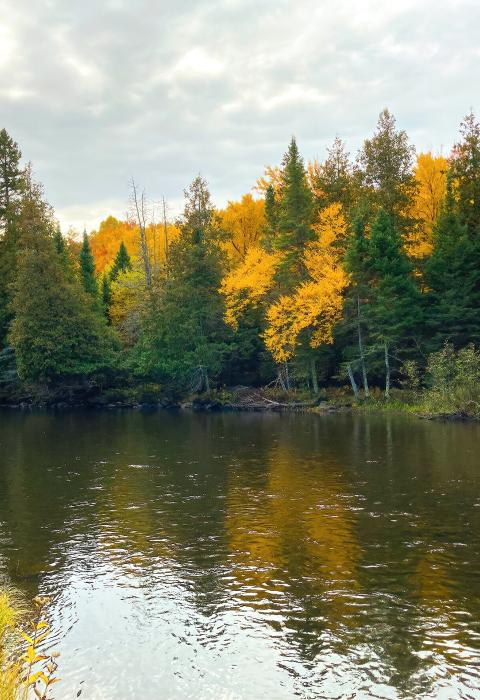
Paint River
Michigan
The North Branch of the Paint River rises in and flows through the Ottawa National Forest to its confluence with the South Branch of the Paint River. The South Branch rises in and flows through the Ottawa National Forest to its confluence with the North Branch Paint River, where it forms the Paint River proper. From this confluence, the Paint River flows on to the Brule River. The wild and scenic designation includes all of the river within the Ottawa National Forest.
Designated Reach
March 3, 1992. The main stem from the confluence of the North and South Branches to the Ottawa National Forest boundary. The North Branch from its origin to its confluence with the South Branch. The South Branch from its origin to its confluence with the North Branch.
Outstandingly Remarkable Values
Fish
Different trout species are found within the North Branch of the Paint River. This branch has better quality aquatic habitat than the main stem, but experiences relatively high summer temperatures. This is due to low groundwater input and numerous headwater natural lakes and impoundments. Some of the tributaries, particularly 33 Creek and Golden Creek, provide cool thermal refugia and superior spawning substrate. Without these tributaries, trout would be rare in this segment.
The South Branch is one of the finest mixed trout fisheries in the Upper Peninsula. This is because of the high production levels of brook and brown trout populations. High groundwater flow, a better than average amount of spawning gravel, and extensive trout habitat restoration work have resulted in outstanding habitat conditions in this very popular fishery. Cooks Run contributes to the high quality of this stream by adding cold water and providing high-quality spawning habitat for brook and brown trout migrating into Cooks Run from the South Branch of the Paint River.
Recreation
North Branch
Much of this segment is a popular canoe route, beginning with a put-in near the bridge on FH-16. Canoeing is limited to high water in the spring or following heavy rains. Portaging is required around rapids, dams, and bridges. Canoeists can take-out at Paint River Forks Campground, just before the confluence with the South Branch Paint River. Access below FH-16 is fair, consisting of access points where county roads cross or run near the river.
This segment is considered a “seasonal” trout fishery, available to trout only during the cool spring and fall months. Much of the year, rock bass and smallmouth bass are the primary fish species. The relatively low numbers of trout tend to produce larger fish where deep holes and overhead cover is available. Nonetheless, trout fishing can be good early in the season. Wide, flat stretches of the river provide the feel of a western river and provide fly-fishing experiences for a wide range of skill levels.
There are opportunities to view wildlife, and deer, bear, and grouse hunting occur within the river corridor. Users experience solitude due to the relatively low recreational use.
South Branch
The South Branch offers numerous recreational opportunities. It is a popular canoe route beginning with a put-in on FH-16 at Elmwood. The best canoeing conditions are during high water in the spring, following significant rain, and below the confluence with Cooks Run. The state’s off-road vehicle and snowmobile trail closely parallels the river for most of the eight miles from FR 3270 to FR 3470 and receives heavy winter use. The Michigan Department of Natural Resources has designated the South Branch as a Blue-Ribbon Trout Stream from Forest Service Road 3270 to the main stem. Its listing as a Blue-Ribbon Trout Stream attracts users from outside the region. Wildlife viewing opportunities are good along the South Branch. Hunting for bear, deer, and grouse also occurs within the river corridor.
Main Stem
Recreational values in this segment attract novices and families to experience river activities throughout the summer. This segment is a popular canoe route, with a put-in at Paint River Forks Campground canoe launch (just upstream of this segment on the North Branch Paint River) and a take-out five miles downstream at Blockhouse Campground. Blockhouse Campground is also used as a put-in for those canoeing further downstream. Except for some shallows in the first two miles or so from the Paint River Forks, there is adequate flow for canoeing throughout the summer. There is some group use of this segment, but generally, use is low, offering opportunities for solitude while using the river. Trout fishing in this segment is a local attraction, especially early in the season. There are many opportunities to view wildlife within the river corridor.
Wildlife
The headwaters of the South Branch of the Paint River has high-quality wetlands and springs used by American bittern, muskrat, beaver, mink, wood duck, wood turtle, mergansers, swamp sparrow, yellow warbler, common yellowthroat, and many other wetland wildlife species. It supports a great blue heron rookery. One regionally sensitive species of dragonfly has been documented here, the pygmy snaketail. The key habitat feature of this segment is the high-quality spring complex (Paint River Springs) and associated wetlands. Riparian aspen forests are common here and in the headwaters, which are in wetland and spring complexes. Connectivity values provided by this segment are also important to riparian wildlife species, both vertebrate and invertebrate.
A regionally sensitive species of mussel, the creek heelsplitter, has been found in the North Branch.

