Kern River
California
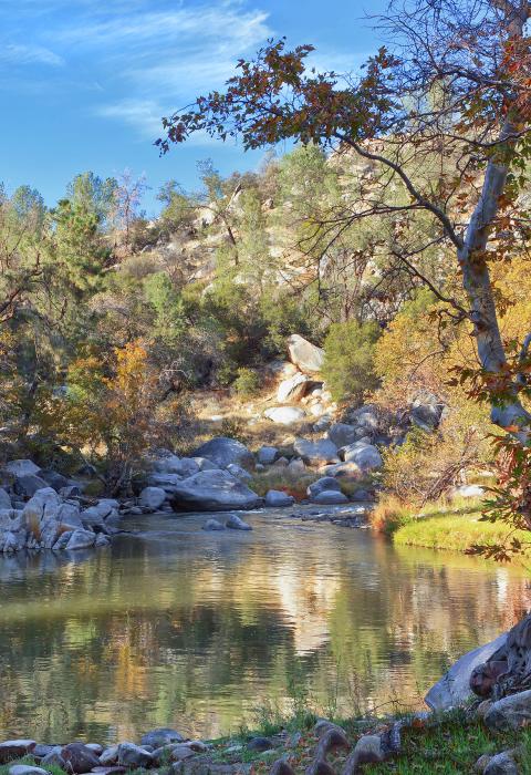
The North and South Forks of the Kern Wild and Scenic River are located within a four-hour drive of more than one-third of the population of southern California. With its range of elevation, topography, and vegetation, the river offers a broad spectrum of recreation opportunities for all seasons of the year. The North Fork flows through Sequoia National Park and the Sequoia National Forest, past large rock formations, spiked-granite protrusions, and sharp rock ledges. The South Fork of the Kern River flows through a diverse landscape, including whitewater, waterfalls, large granite outcrops interspersed with open areas, and open meadows with extensive vistas. Principal outdoor recreation activities include fishing, hiking, camping, and whitewater boating.
Designated Reach
November 24, 1987. The North Fork from the Tulare-Kern County line to its headwaters in Sequoia National Park. The South Fork from its headwaters in the Inyo National Forest to the southern boundary of the Domelands Wilderness in the Sequoia National Forest.
Outstandingly Remarkable Values
Botany
The corridor contains regionally uncommon wetland habitat at Kern Lakes and the alkaline seep at the Forks of the Kern. The wetland habitat contains several uncommon aquatic and marsh species; the alkaline seep also supports several uncommon plants.
The area provides a Great Basin vegetation type not normally found in the Sierra Nevada, making it floristically unique. There are also populations of several uncommon species in Ramshaw Meadows.
Culture
There are prehistoric and historic sites throughout the corridor.
Fish
The river's deep pool habitat supports a population of wild trout and vividly colored hybrid trout. The North Fork Kern has the rarest, and likely the highest, distinct native subspecies of trout in the Sierra Nevada, the Kern River rainbow trout.
Geology
The North Fork Kern River Canyon, within the Golden Trout Wilderness, may be the longest linear glacially sculpted valley in the world. It contains regionally unique features referred to as Kernbuts and Kerncols. These rounded to elongated (parallel to the axis of the canyon) granitic knobs (Kernbuts) and the depressions between them (Kerncols) were first identified and named in the Kern Canyon.
Numerous domes, volcanic outcrops, falls, and steep granitic gorge can be found here. The Domeland Wilderness section is primarily dominated by Mesozoic granitic rock with numerous domes. Three major Tertiary volcanic outcrops lie between Taylor and Manter Creeks. There are several small falls along the South Fork in the Domeland Wilderness, especially on Taylor and Manter Creeks. The river below Rockhouse Meadow flows through a rugged and steep granitic gorge where whitewater rapids are common.
This is an interesting geologic area that contains an excellent example of a volcanic dome (Monache Mountain). Monache Meadows contains extensive alluvium with most of the west bank granitic in origin, and the east bank pre-Cenozoic granitic and metamorphic rocks.
Recreation
Many recreation opportunities lie within a near-wilderness setting, including excellent hiking, horseback riding (pack trips), camping, fishing, and solitude. With a gradient of 30 feet per mile, the North Fork of the Kern River is one of the steepest and wildest whitewater rivers in North America. The Forks Run is a nearly continuous series of Class IV and V rapids and waterfalls. The Upper Kern is a popular stretch of river for whitewater boating, camping, and fishing.
Scenery
The river flows alternately through open meadows and steep-sided canyons. Much of the river is characterized by a V-shaped valley, which gently bends around or disappears behind canyon walls into a linear series of river views. There are panoramic views of the Monache Meadows and timbered, sometimes steep hills with a diversity of scenery. The area is sharply contrasted by the spiked granite protrusions of the Needles Formation, the basalt plateau formation above Needles Camp, and the sharp edges of occasional rock ledges that run down the faces. Creeks cascade down smooth white granite bedrock that contrasts with the rough, darker colors of the adjacent metamorphic formation. Segment contains large, clear pools framed by rock sides, waterfalls, and series of cataracts.
Wildlife
The river is the only known habitat for a distinct species of salamander in the genus Batrachoseps.

