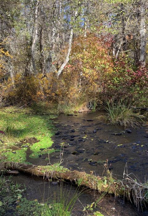
Spring Creek
Oregon
Located deep within southwest Oregon’s Cascade-Siskiyou National Monument, Spring Creek percolates out of the ground from its source at Shoat Springs. Situated within a geographic region of exceptionally high biodiversity, Oregon’s superlative Klamath-Cascade Mountains are the dynamic meeting place of the Klamath, Cascade, and western Great Basin Ecological Provinces. In addition to the rich plant and forest diversity, this area supports a range of wildlife habitats, including spring, fall, and winter range for a large herd of migratory black-tailed deer and healthy populations of bear, coyote, mountain lion, and bobcat. A tributary of the Jenny Creek, which is also a wild and scenic river, the ice-cold waters of Spring Creek support the unique fish species found in that river.
At just 1.1 miles, this short-but-mighty designated river is almost entirely located on privately owned land. Visitors are encouraged to respect the private property.
In 2019, the John D. Dingell Jr. Conservation, Management and Recreation Act (Public Law 116-9; Dingell Act) designated 1.1 miles of the creek as a scenic river to be managed by the U.S. Department of Interior. Following designation, outstandingly remarkable values were identified in the Congressional Record (September 11, 2019, Volume 165, Issue 145) as fish, wildlife, and scenery.
Designated Reach
March 12, 2019. From from its source at Shoat Springs downstream to the confluence with Jenny Creek.
Outstandingly Remarkable Values
Preliminary Finding
Fish
The gin-clear, cold, flowing waters of Spring Creek support a rich diversity of fish species, including an endemic population of the geographically isolated redband trout.
Preliminary Finding
Scenery
The diverse vegetation types—including towering stands of Ponderosa pine and Douglas fir, open grasslands, meadows, and shrublands—merge with the rolling, mountainous topography and the cold, clear spring water to support exemplary scenic views of the creek and the surrounding area.
Preliminary Finding
Wildlife
Spring Creek hosts a unique assemblage of native species, including several endemic snails, northern Pacific pond turtle, and possibly the dwarf western pearl shell mussel. The intact riparian vegetation along the creek provides essential cover and habitat for a rich variety of bird life which rely on the flowing waters of this spring-fed creek.

