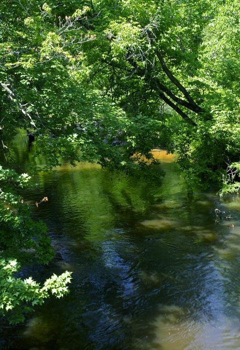
Bear Creek
Michigan
Bear Creek is located in the lower peninsula of Michigan near Manistee and meanders through lush swamps, rolling hills, and farmland. The river corridor provides a peaceful experience in a natural, densely vegetated river setting.
Designated Reach
March 3, 1992. From Coates Highway to the confluence with the Manistee River.
Outstandingly Remarkable Values
Recreation
The Bear Creek corridor is relatively undeveloped, providing recreational opportunities for those seeking solitude in an otherwise developed region. The primary recreational activity is fishing, with healthy populations of resident trout and excellent salmon and steelhead runs in the spring and fall. Although recreation use is low, canoeing is gaining popularity, especially for those with more advanced canoeing skills. Due to the size of the stream, canoeists must occasionally stop and push their boats through low water areas. Thus, the degree of difficulty attracts users seeking a sense of adventure. Since there is limited access to the river, hunting is the only other major recreational activity in the river corridor.
The primary access to the river is at Coates Highway on the northernmost boundary of the National Wild and Scenic River and Bear Creek River Access Site on River Road to the south. Only a minor amount of dispersed camping occurs in the area. The Bear Creek River Access Site requires a vehicle parking pass under the Recreation Enhancement Act.
Scenery
Bear Creek is located in the lower peninsula of Michigan near Manistee and meanders through lush swamps, rolling hills, and farmland. The river corridor provides a peaceful experience in a natural, densely vegetated river setting.
Wildlife
The relative inaccessibility of Bear Creek has resulted in a fairly undisturbed riparian habitat attractive to wildlife.

