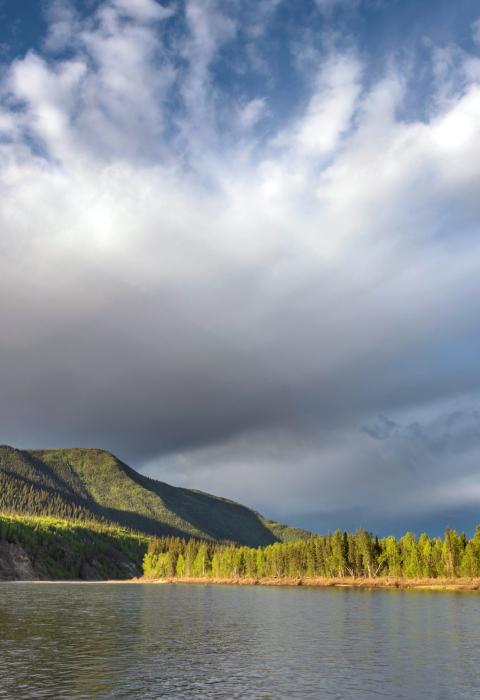
Charley River
Alaska
The Charley River originates in the Yukon-Tanana uplands and flows northwards about 108 miles to the Yukon River. The river flows through three distinct topographic regions—open upland valley, entrenched river, and open floodplain—offering varied, sometimes spectacular, scenery, as well as unspoiled wilderness. Arising at 4,000 feet of elevation, the Charley empties into the Yukon 700 feet above sea level, for an average gradient of 31 feet per mile and an average current of 4 to 6 miles per hour. Side-streams have worn away old heights, softening the shapes of all but a few alpine peaks.
Designated Reach
December 2, 1980. The entire river, including its major tributaries—Copper Creek, Bonanza Creek, Hosford Creek, Derwent Creek, Flat-Orthmer Creek, Crescent Creek, and Moraine Creek—within the Yukon-Charley Rivers National Preserve.
Outstandingly Remarkable Values
Culture
The only remaining visible evidence of man’s limited activities in the basin are a few cabins. An abandoned mine camp on Bonanza Creek is believed to exist but has not been located. Archeological resources have been found in the basin, mainly in the Copper Creek area, where resources include evidence of early man’s presence in the area. The wreckage of a historically significant World War II B-24 bomber is located in the upper watershed.
Ecology
Vegetation within the basin reflect little evidence of glacial or human activity and constitutes an excellent representation of the local effects of fire, slope, aspect, and the presence or absence of permafrost. The vegetation includes most types typical of interior Alaska, ranging from alpine tundra in the upland valleys, through spruce/hardwood forests in the entrenched portions, to floodplain thickets on the newly formed alluvial deposits around the mouth of the river.
Fish
The area is considered good to excellent for grayling sportfishing. Northern pike are found as far as 16 miles upstream, and sheefish and king, chum, and coho salmon are occasionally found in the river.
Geology
The geology of the basin is unusual because, unlike most mountainous portions of Alaska, this region was not extensively glaciated and consequently contains a substantially unaltered geologic record. The glacial moraine above Moraine Creek is one of the few evidences of glacial activity in this region. Another distinctive feature of the basin is the Tintina Fault. The Charley cuts through this fault just before entering the mature floodplain, exposing an unusual conglomerate formation of angular blocks in association with river-worn boulders.
Recreation
The Charley is one of the best clearwater boating streams in Alaska, offering excellent opportunities for canoeing, rafting, and kayaking. Most floaters use inflatable rafts or kayaks because of their ease of transport by air to the headwaters.
During high water, the upper two-thirds of the river provide a good whitewater experience. As the water level lowers, maneuvering becomes a constant necessity, and some rapids require scouting to determine the best channel. Most of the Charley is rated as Class II water, with limited areas rated as Class III.
Wildlife
The basin provides habitat for abundant and varied wildlife. Among the most notable big game species are caribou and Dall sheep. The Charley River is one of the few rivers in Alaska that supports a population of Dall sheep along its banks during summer months.
The basin also contains a mixture of birdlife. The open, mature floodplain provides nesting habitat for numerous waterfowl and rich feeding grounds for peregrine falcons. Peregrine nesting habitat is provided by the riverside cliffs in the entrenched middle portion of the river. Gyrfalcons nest and hunt in the open tundra stretches of the upper river.

