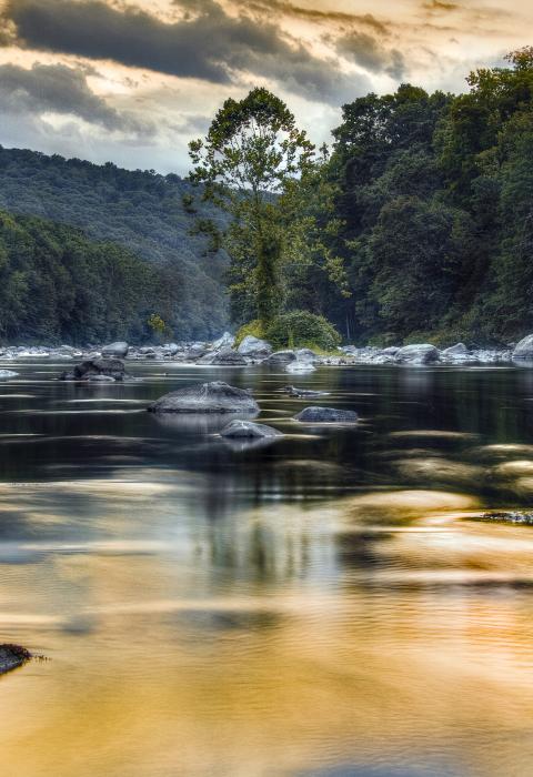
Lower Farmington River & Salmon Brook
Connecticut
Located about halfway between New York City and Boston, the Farmington River is the largest tributary of the Connecticut River, and Salmon Brook is the largest, and arguably most important, tributary to the Farmington. Salmon Brook joins the Farmington River in the town of East Granby, Connecticut, about ten miles northwest of the city of Hartford. The Farmington River joins the Connecticut River in town of Windsor, Connecticut, 55 miles north of the Long Island Sound and 13.1 miles south of the Massachusetts state line.
The Lower Farmington River and Salmon Brook support natural, cultural, and recreational resources of exceptional significance to the citizens of Connecticut and the nation. There is strong local support for the protection of the rivers, including votes of support for wild and scenic designation from the governing bodies of all ten communities abutting the study area including Avon, Bloomfield, Burlington, Canton, East Granby, Farmington, Granby, Hartland, Simsbury, and Windsor.
The river corridors boast a remarkable combination of varied geology; healthy forested watershed; excellent fishing and paddling areas; well-kept walking and biking trails; diverse communities of plants, wildlife, fish, and aquatic invertebrates; rich agricultural soils; archaeological sites; historic towns and landmarks; and striking scenic views.
Designated Reach
March 12, 2019. Multiple segments and tributaries are designated.
- The main stem of the Farmington River beginning 0.2 miles below the tailrace of the Lower Collinsville Dam and extending to the site of the Spoonville Dam in Bloomfield and East Granby.
- The main stem of the Farmington River extending from 0.5 miles below the Rainbow Dam to the confluence with the Connecticut River in Windsor.
- The East Branch of Salmon Brook extending from the Massachusetts-Connecticut State line to the confluence with the West Branch of Salmon Brook.
- The West Branch of Salmon Brook extending from its headwaters in Hartland, Connecticut, to its confluence with the East Branch of Salmon Brook.
- The main stem of Salmon Brook extending from the confluence of the East and West Branches to the confluence with the Farmington River.
Outstandingly Remarkable Values
Biodiversity
The watershed as a whole comprises ten ecoregions, or areas with distinctive ecological and physical features. It also provides a critical dispersal and migratory route for both terrestrial and aquatic wildlife.
There are 19 state-listed plant species within the corridor, including the only known population of dwarf bulrush in a river ecosystem and the only known population of purple giant hyssop in Connecticut. Nearly the entire population of starry campion in all of New England is supported by the corridor’s floodplain forest.
The river itself is the only one known to support all 12 of the freshwater mussel species native to southern New England. The Farmington River may contain one of the New England’s most—and Connecticut’s only—viable dwarf wedgemussel populations.
Salmon Brook exhibits a basin-wide distribution of high-quality fish communities, which is rare in Connecticut. At least 25 species of finfish are present in Salmon Brook and 30 species in the lower Farmington River. The Salmon Brook supports an exceptional recreational fishery starring brown and native brook trout. Migratory fish, such as American shad, blueback herring, alewife, American eel, and Atlantic salmon, have excellent spawning habitat in the lower Farmington corridor. The mouth of the Farmington River where it meets the Connecticut River is the most diverse and one of the most important areas within New England in terms of fish resources. All 12 of the diadromous fish species thought to be present in the state are believed to be present at this location.
Culture
The cultural landscape of the Lower Farmington River and Salmon Brook includes both American Indian and post-contact resources recognized as nationally and regionally significant. Initial human occupation of the area along the Lower Farmington River and Salmon Brook dates back to the end of the Pleistocene about 11,000 years ago. The river and brook were clearly important to the existence of these early settlements as source of water, food, and transportation routes.
Significant historical themes exhibited in the Lower Farmington Valley for the post-contact period include early colonial New England settlement patterns, nineteenth century industrialism, and the rise of industrial agriculture as exemplified by tobacco farming. Agricultural settlements used the river’s waterpower for gristmills, sawmills, and fulling mills, and entrepreneurs established waterpower industries and factories all along the river and its tributaries. Some Farmington homes likely served as Underground Railroad stations. Farmington, then a largely agricultural community, served as a hub for various Underground Railroad routes and abolitionist activism.
Geology
The role that watercourses and glaciation had in forming the landscape of the Farmington River Valley is evident in the path of the river, development patterns, and land uses. The river was diverted north from its original southern flowing trajectory due to a classic glacial diversion. The evidence of a glacial process is a unique opportunity for Connecticut residents to witness as they traverse the river valley and find the river to flow south, north and east; all within a small geographic area. A billion years of geologic history is represented by the area’s geological features. The Farmington is the only river in Connecticut that flows over both the state’s oldest and youngest bedrock.
Recreation
The variety of boating, fishing, and water-based recreational activities is unique regionally because of the consistent year-round flows, clean water, and quality of the resources. Boating on the watercourses can be experienced by people of many skill levels due to the diversity of paddling opportunities, ranging from flat-water to Class II and III for experienced paddlers. The high-quality fisheries of the Farmington and Salmon Brook’s diverse and well-preserved aquatic habitats also provide for exceptional fishing. The clean, cold-water trout fisheries of the Salmon Brook provide some of the most outstanding opportunities for angling anywhere in Connecticut.

