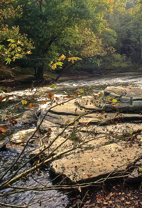
Little Beaver Creek
Ohio
Little Beaver Creek represents some of the most rugged and wildest land in Ohio. Forested to a width of over a mile in places, this stream is pristine enough to be the home of the endangered hellbender (large aquatic salamander), and it retains its original aquatic community. From ridges topping over 200 feet, there are breathtaking views of the valley below.
Designated Reach
October 23, 1975. The main stem from the confluence of the West Fork with the Middle Fork near Williamsport to the mouth. The North Fork from its confluence with Brush Run to its confluence with the main stem at Fredericktown. The Middle Fork from the vicinity of the County Road 901 (Elkston Road) bridge crossing to its confluence with the West Fork near Williamsport. The West Fork from the vicinity of the County Road 914 (Y-Camp Road) bridge crossing to its confluence with the Middle Fork near Williamsport.
Outstandingly Remarkable Values
Ecology
The flora of the Little Beaver Creek watershed is richly abundant and extremely diverse. Extremes in topography and microclimatic conditions have resulted in the great variety of plant life which abounds in the region. This diversity can be attributed to a variety of influence, but none more significant than that of the area's glacial history. The most extensive and least disturbed areas of the forest occur in the rugged terrain and deep gorge areas in the southern part of the watershed.
Fish
Sixty-three species of fish have been recorded in watershed streams. A significant fishery exists for smallmouth bass, largemouth bass, channel catfish, flathead catfish, rockbass, white crappie, bluegills, and suckers. Tributary streams of the Little Beaver are among only several in Ohio which provide water cold and clear enough for trout releases. However, summer water temperatures become too high to sustain adequate reproduction and permanent populations of trout.
Geology
The geology and topography of the Little Beaver Creek basin is more diverse than that of most other drainage basins in Ohio. The upper portions of the basin have been glaciated, while the lower portions have been modified by long cycles of erosion. Due to the glacial influence, the most striking portion of the watershed is the most southerly segment. In this area, the topography is entirely due to usual erosive forces, and the landscape is hilly and rugged. This part of the Allegheny plateau has been dissected by both the pre-glacial stream and the Little Beaver.
History
Thomas Hutchins, the first Geographer General of the United States, was directed in 1785 by President George Washington to commence the U. S. Public Land Survey at a point near the mouth of Little Beaver Creek. It turned out to be the greatest subdivision on earth and the first time that land was surveyed before it was sold.
The combination of rich agricultural lands and the rapidly growing industry of the area resulted in the need for a better system of exporting agricultural products and importing the goods needed to support the growing industries. In recognition of this problem, in 1822 the Ohio Legislature passed a resolution endorsing a system of canals in Ohio. The main purpose of the canal was to connect the Ohio River to other Ohio and Pennsylvania canal systems. In 1848, the canal was completed. The project involved the construction of 30 dams, 90 locks, and 2 tunnels. Remnants of the short-lived canal system are well preserved throughout the region.
Recreation
Little Beaver Creek and its surrounding valley supports a variety of interesting and enjoyable recreation activities in a near natural and scenic setting. Most of the existing use occurs at Beaver Creek State Park. Recreational activities most closely associated with the Little Beaver include camping, hiking, canoeing, hunting, fishing, nature study, picnicking, horseback riding, sightseeing, and swimming.
Although canoeing use is limited by low flows during the primary recreation months of June, July, and August, the opportunity for participation in this activity is substantial. Floating the Little Beaver during the spring months of April and May when water levels are higher is an interesting and rewarding trip for the canoeist.
Scenery
Little Beaver Creek and surrounding valley contains some of the wildest and most scenic areas in Ohio. It is a river of steeply incised valleys; abundantly wooded slopes; occasional steep rock outcroppings; boulder-strewn, fast moving rapids and riffles; quiet pools; and clear, swift-flowing feeder streams. The river exhibits a noticeable absence of man-made developments but supports a great variety of interesting plant, animal, and bird life.
Wildlife
Little Beaver Creek and its tributaries, with the excellent habitat surrounding the streams, provide an environment supporting an impressive array of wildlife. Reptiles and amphibians are numerous in the Little Beaver Creek watershed. Included are 14 species of snakes; at least six species of turtles; 11 species of frogs and toads, of which the woodfrog is unusually abundant; and 13 species of salamanders, including the hellbender and mudpuppy. A total of 49 species of mammals occur in the watershed. One of the most interesting mammals, the beaver, is well established. The Little Beaver Creek watershed supports an outstanding variety of bird life. A total of 269 species use the area on an annual basis. Of this total, 33 species are considered year-round residents; 140 species migrate through and sometimes nest in the watershed; and 96 species migrate through the watershed.

