Musconetcong River
New Jersey
The Musconetcong River drains a 157.6-square-mile watershed area in northern New Jersey, and, as a major tributary to the Delaware River, is part of the larger (12,755-square-miles) Delaware River watershed. The 42.5-mile river in a general southwest direction to the Delaware River and ultimately to the Delaware Bay.
The Musconetcong River, nestled in the heart of the distinctive New Jersey Highlands region, features a remarkably diverse array of natural and cultural resources. The limestone geologic features present in the river corridor are unique in the region, and the steep slopes and forested ridges in the upper segments of the river corridor stand in stark contrast with the historic hamlets, pastures, and rolling agricultural lands at the middle and lower end of the river valley.
Because the Musconetcong River corridor is located in a more remote part of New Jersey, much of the corridor's historical and archeological resources remain intact. Dozens of culturally significant historic and archeological resources—many of which are registered in the State and National Registers of Historic Places—can be found along the 28.5 miles of the river's federal designation. Waterloo Village, Stanhope, Asbury, and Finesville are places that bring visitors back to earlier times and underscore the importance of the Musconetcong River as the sustaining resource that established them.
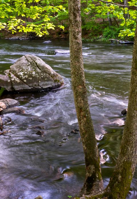
The Musconetcong River also offers exemplary natural resources, often referred to as the best trout fishery in New Jersey. Brown trout can be found in the designated river's seven main tributaries, and anglers in the region have access to the river from hundreds of acres of publicly owned lands along the river's banks. Paddlers enjoy the river's rapid flows, and hikers trek the miles of hilly trails that flank the river, affording stunning views of the river corridor.
The Musconetcong is a "Partnership River" whereby a number of municipalities coordinate on its management with the National Park Service.
Designated Reach
December 22, 2006. The 3.5-mile segment from Saxton Falls to the Route 46 Bridge and the 20.7-mile from the King's Highway Bridge to the railroad tunnels at Musconetcong Gorge.
June 3, 2022. The 4.3-mile segment from Hughesville Mill to the confluence with the Delaware River.
Outstandingly Remarkable Values
History
The Musconetcong River Valley contains many river-related historic bridges, mills, and historic districts that are listed on the National Register of Historic Places. One river-related resource, the Morris Canal Historic District, is a National Historic Civil Engineering Landmark and was judged to be nationally exemplary.
Culture
Human habitation in the Musconetcong River corridor has been traced back 12,000 years, when Paleo-Indians occupied the area during the retreat of the Wisconsin Glacier. Evidence of human habitation has been found at the Plenge Site, along the lower Musconetcong River corridor. The site was one of only two major Paleo-Indian archaeological site excavations in New Jersey, and it is considered to be one of the most important in the northeastern United States.
Recreation
The river corridor provides a high-quality environment for a wide variety of recreational activities which are important to the local economy. State, county, and local parklands within the river corridor provide significant opportunities for hiking, fishing, canoeing, camping, nature study, and other outdoor activities.
The river is also an important source of boating recreation (primarily paddlecraft). The most frequently paddled sections of the river are between Beattystown and Bloomsbury. There is little or no intrusive power boating in the Musconetcong River, as the river is normally too shallow for power boating.
The Musconetcong is one of the most popular trout fishing streams in New Jersey and the surrounding region. The river and its tributaries are regionally important trout fishing streams. Approximately 20 of the tributary streams support naturally reproducing trout populations.
Scenery
The unique geologic features of the Musconetcong River Valley play a major role in determining its scenic character. The prominent ridges that parallel both sides of the valley provide an unmistakable definition to the landscape. Long stretches of the river valley are wide and straight enough to allow for sweeping views of gently sloping farmland and forested ridgelines. The river itself contains many hidden away areas that provide intimate views of mature forests. Several locations in the river corridor offer outstanding views of the agricultural river valley, Highland Ridges, Kittatinny Mountain, and Delaware Water Gap.
Wildlife
Regionally important populations of wildlife and critical habitat for state listed threatened, endangered, or rare species are present within the river corridor. The Musconetcong River watershed lies entirely within the New Jersey Highlands Region, a landscape of national importance as determined by the U.S. Forest Service. The Musconetcong River is also an important wildlife corridor due to its relationship to the Delaware River Flyway, a migratory route for songbirds, shorebirds, and waterfowl, and one of four major bird migratory routes in North America.

