Richland Creek
Arkansas
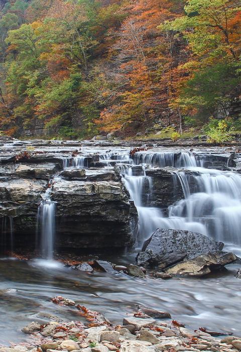
The wild and scenic portion of Richland Creeks is 16.5 miles long and is located in Newton and Searcy Counties. The entire creek flows 29.6 miles northeast to its confluence with the Buffalo River near Woolum. Richland Creek Falls, Twin Falls, upland swamp, fossiliferous limestones, and smallmouth bass fishing are some of the features of this Ozark Mountains stream as it flows through the Richland Creek Wilderness.
At all times of the year, after significant rainfall, but primarily in the winter and spring rainy season, Richland Creek is heavily used by canoeists and kayakers for whitewater floating. The creek contains numerous Class II, III, and IV rapids and waterfalls.
There is a small campground containing nine camping units at Richland Recreation Area located on Forest Service Road 1205 and Richland Creek. The area is a popular camping spot and parking area for the Ozark Highlands Trail and hiking up to Twin Falls and Richland Falls, which are both within the Richland Creek Wilderness although only the latter is in the river corridor.
Designated Reach
April 22, 1992. From its origin to the northern boundary of section 32, T14N, R18W.
Outstandingly Remarkable Values
Botany
An upland swamp containing overcup oak, buttonbush, and sweetgum exists within the corridor. This upland swamp is an important botanical, soils, and geologic resource, because it may help in understanding the physiographic and phytogeographic history of the Ozarks.
Geology
The exposed bedrock of the river displays geological formations which are very important to understanding the stratigraphic synthesis of north Arkansas. Exposed fossiliferous limestones and shales seem to represent some of the youngest Mississippian age rocks in North America.
Recreation
Canoeing, kayaking, horseback riding, camping, picnicking, swimming, and fishing are the primary forms of recreation. The Richland Recreation Area is heavily used during the summer months due to swimming and fishing holes that are popular with local residents.
Other
Wilderness
The Richland Creek Wilderness was designated by Congress in 1984. Since wilderness designation effect broad reaches of land, the broader watershed of which the river is a part, and it has important complementary benefits.

