North Fork Smith River
Oregon
There are 13 miles of the North Fork Smith River in Oregon. Designated as wild and scenic in 1988, the two wild sections extend from the headwaters to Horse Creek and from Baldface Creek to the Oregon/California state line. The portion between Horse Creek and Baldface Creek is classified as scenic.
The North Fork of the Smith River is a relatively low-gradient river, dropping approximately 1,800 feet from an elevation of 2,900 feet in its headwaters in the Kalmiopsis Wilderness to 1,100 feet at the Oregon/California border. The North Fork flows south from the flank of Chetco Peak in the Kalmiopsis Wilderness to its confluence with the Smith River in California, creating one of the best protected river systems in the National Wild & Scenic Rivers System.
Designated Reach
October 28, 1988. From its headwaters to the Oregon-California state line.
Outstandingly Remarkable Values
Fish
The North Fork of the Smith River's fishery, typical of Pacific coastal systems, is dominated by trout and salmon. Winter steelhead and sea-run cutthroat trout are the predominant anadromous species on the North Fork. Some populations of coho, Chinook (both fall and spring run), and summer steelhead are found in the lower reaches of the river, primarily in California. The North Fork provides seven miles of near-pristine steelhead spawning and rearing habitat and is a significant source of the high-quality water on which the anadromous fishery of the Smith River depends.
Recreation
The primary recreational attractions in the watershed are the Kalmiopsis Wilderness, Sourdough Camp, and several trails. Sourdough Camp offers excellent dispersed car camping and is located south of the Kalmiopsis Wilderness at the confluence of Bald Face Creek and the North Fork. Sourdough Camp is undeveloped, but there are existing traditionally used sites which should be used to concentrate camping impacts.
Scenery
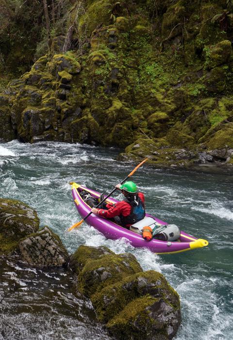
The scenic quality in the river corridor is a result of a combination of the color, geology, water, and vegetation features. Factors contributing to site-specific scenic diversity include large rocks, deep pools, exposed outcrops of peridotite (or serpentinite), a variety of soil types and colors, a variety of plant life (including old growth Douglas-fir), anadromous fisheries, wildlife, and emerald-colored water.
Water Quality
The North Fork Smith River is known for its outstanding water quality and for its ability to clear quickly following storms. Low turbidity and lack of pollutants contribute to the river's excellent habitat and high fisheries value.

