Sturgeon River (Ottawa National Forest)
Sturgeon River (Ottawa National Forest)
Michigan
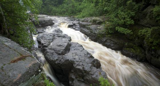
This river flows through a narrow, dissected, gorge-like valley with an average depth of 200-300 feet and through the Sturgeon River Gorge Wilderness.
Designated Reach
March 3, 1992. From its entry into the Ottawa National Forest to the northern boundary of the Ottawa National Forest.
Outstandingly Remarkable Values
Fish
One of two remaining self-sustaining lake sturgeon populations is found in the Sturgeon River below Prickett Reservoir, contributing to the outstandingly remarkable fish values. Populations of steelhead and walleyes occur here, as well. Habitat consists of a moderately high-gradient, cobble-bottomed riffle providing excellent spawning habitat for several species (lake sturgeon, steelhead, and walleye). This small, yet productive, spawning area could be used as a source for lake sturgeon species recovery in the future.
Geology
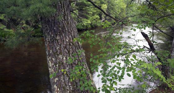
The Sturgeon River flows through a steep valley that displays a range of geological features. The valley becomes progressively wider, and the river meanders throughout this broad valley bottom forming some of the best examples of oxbow lakes, wetlands, ancient river terraces, and everchanging floodplain terraces on the forest. The river bottom is characterized by gravel bars and large boulders. Valley walls are quite steep and unstable in places, but become shorter and less pronounced downstream. The soil becomes less coarsely textured and more silty and loamy. The spectacular river valleys and highly erosive sandy soil composition is unique and uncommon to the region.
Recreation
Recreation opportunities draw visitors from outside the geographic area, particularly because of the wilderness designation; a portion of the river is within the Sturgeon River Gorge Wilderness where there is ample opportunity for solitude. There are numerous points where the river can be viewed, including locations along Forest System Roads and from the Sturgeon River Campground. There are few opportunities for canoeing and kayaking in this segment due to the gorge and other hazardous stretches. Trout fishing opportunities are good despite limited access points.
Scenery
The broad valley bottom, with its oxbow ponds, wetlands, and terraces, coupled with the steep valley walls create a striking landscape. Vegetation along the river is made up of a variety of tree species, brushes, and wetland species that contribute to the scenery, especially in fall. The combination of extensive, distinct landforms, and a broad meandering watercourse create a landscape that is unique in the region.
Wildlife
Extensive white pine forests are home to pine warblers and martens. The river is often wide and shallow, with many off-channel wetlands and oxbows, which provide a wide variety of wildlife habitat. Riparian forests within this corridor are very productive wildlife habitats, important to invertebrates and vertebrates of many taxa. Overall, the river corridor provides connectivity across the landscape for numerous riparian and migratory wildlife species.
Of particular significance, wood turtles can be found here. Where the river flows through a gorge with steep and eroding banks, it creates ideal nesting habitat for the wood turtles.
The clubtail dragonfly, a species of concern, is present in the area. In addition, bald eagles, gray wolves, and other species utilize this area.