Malheur River
Malheur River
Oregon
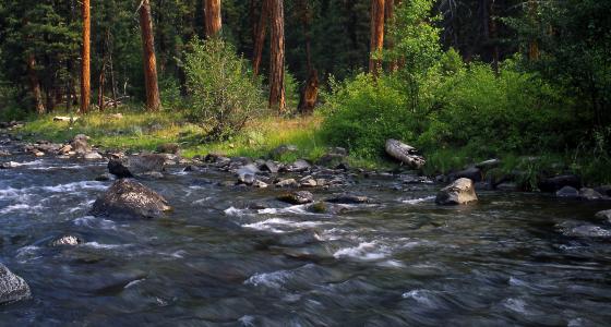
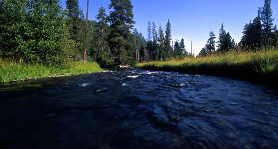
The Malheur River is located in eastern Oregon and exhibits outstanding scenery, geology, wildlife habitat, and history. It drains a high desert area, between the Harney Basin and the Blue Mountains and the Snake River, eventually flowing into the Snake River.
The name of the river is derived from the French for “misfortune.” The name was attached to the river by French Canadian voyageur trappers working for the North West Company when cached beaver furs were snatched by Native Americans. The name first appears in the record in 1826 when Peter Skene Ogden, a fur trapper with the Hudson’s Bay Company, referred to it as “River au Malheur” (from rivière au Malheur, literally “River of the Misfortune”).
The river provides a variety of recreational opportunities for visitors willing to travel to its remote location, including trout fishing, hiking, horseback riding, and camping.
Designated Reach
October 28, 1988. From Bosenberg Creek to the Malheur National Forest boundary.
Outstandingly Remarkable Values
Geology
The river corridor is generally characterized by a rugged and steep canyon ranging from 300- to 1000-feet deep. The canyon geology is evident in the various rock outcrops, talus slopes and cliffs created by erosion as the river cut through many layers of volcanic material deposited between 12 to 15 million years ago. The geologic formations of the corridor contribute to the scenic diversity of the landscape.
History
The historic value of the river corridor centers around the early logging practices which occurred there. Remains of an old splash dam, logging camps, and numerous high stumps attest to the early economic importance of the river to settlers of northern Harney County around the turn of the century.
Scenery
The scenery of the river corridor is composed of combinations of water, landform, variety, color of vegetation, and interesting old-growth tree stands. For the most part, evidence of human presence is limited. Scenic vistas from the canyon rims and views up and down canyon from the river are spectacular.
Wildlife
Wildlife habitat in the canyon is relatively undisturbed with a diversity of high-quality habitat components, including old-growth tree stands. The river corridor also provides important connectivity between the Blue Mountains and Great Basin physiographic provinces.